2016 - 2017
Units, Scales and Measures
-
Max Bontoft (2nd Year)
Atomospheric Commons

As
drones have become increasingly present in the sky, airspace has begun to go
through a series of transformations. As they take flight over our cities, they
have necessitated a dialogue about its definition, regulation and inhabitation
- territories beginning to be unpacked in new systems of invisible power.
Governance of aerial action is beginning to reflect down towards the ground.
Drone technology’s presence is inevitable and its rapid propagation and
dispersion across altitudes is imminent.
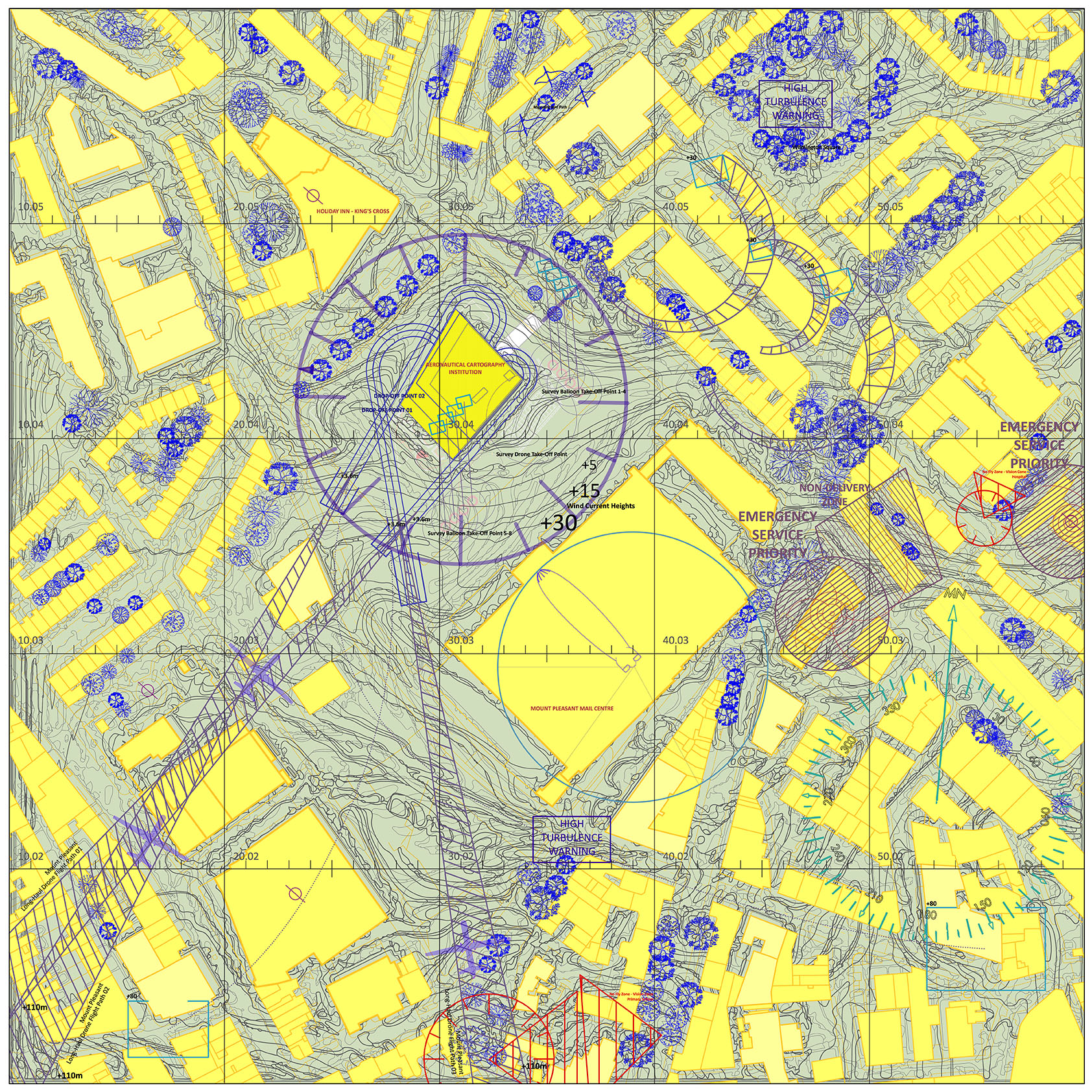
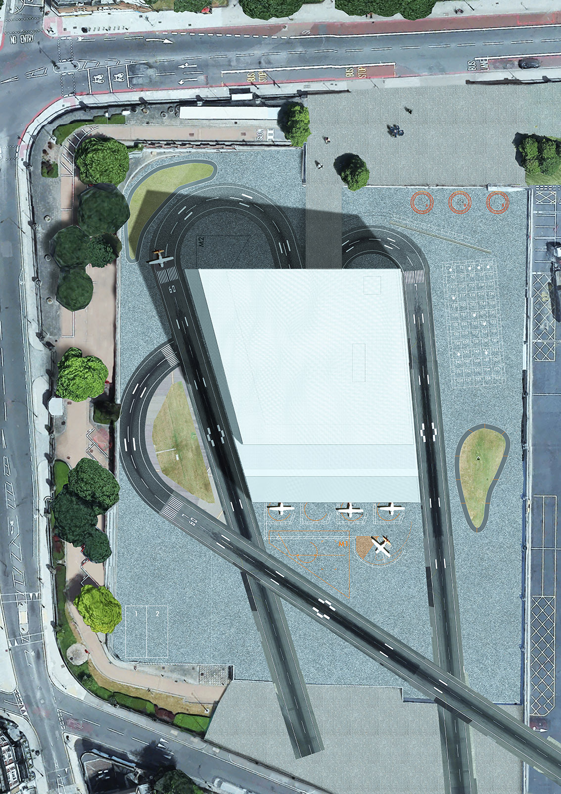
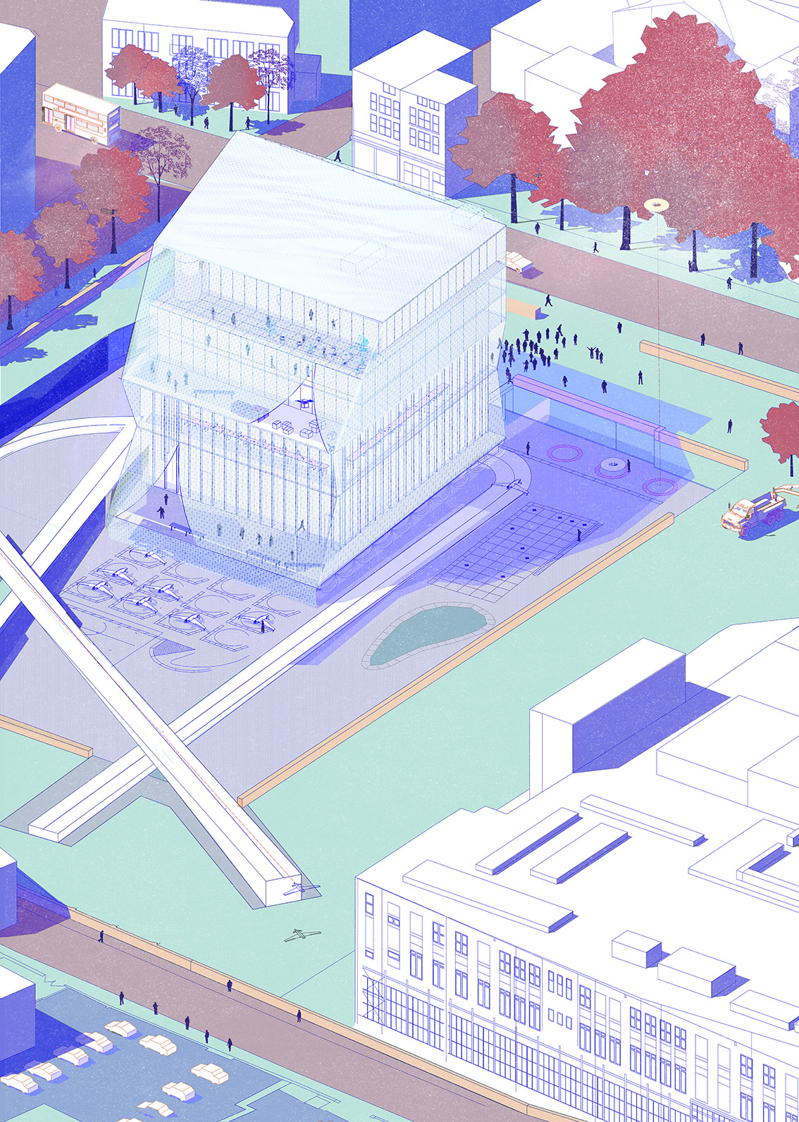
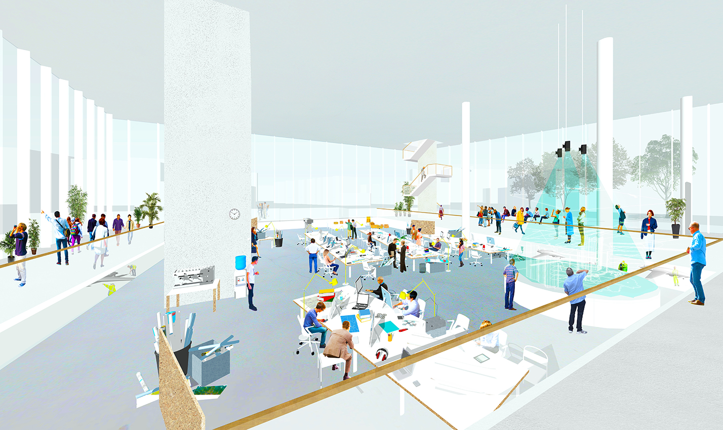
The proposal is an Institute for Aeronautical Cartography. It brings drone aerospace management to the fore and enables the drone to take on a more positive persona in the eye’s of the metropolis’ residents. It is sited on the increasingly redundant ground of the Mail Centre at Mount Pleasant in Islington, a space once criss-crossed by the coming and going of parcel-laden postal vans and the subterranean mail rail. The building is also as a prototype, an exemplar for how others might begin to architecturally adapt themselves to accommodate this new infrastructure. The site markings on the runways and external balconies manifest the mediation between ground and sky and internal spaces are rearranged to the design of details that point skyward. This is an aeronautical geography reflected back at the surface of the earth.
---
Find out more with Max’s research article ->
© Copyright 2014-2017 Institutional Forms and Urban Logics - if you have any questions please email admin@institutionalforms.com